




|
Quantity
|
Out of stock
|
||
|
|
|||
|
|
|||
TOPART Design and General Operating Principles
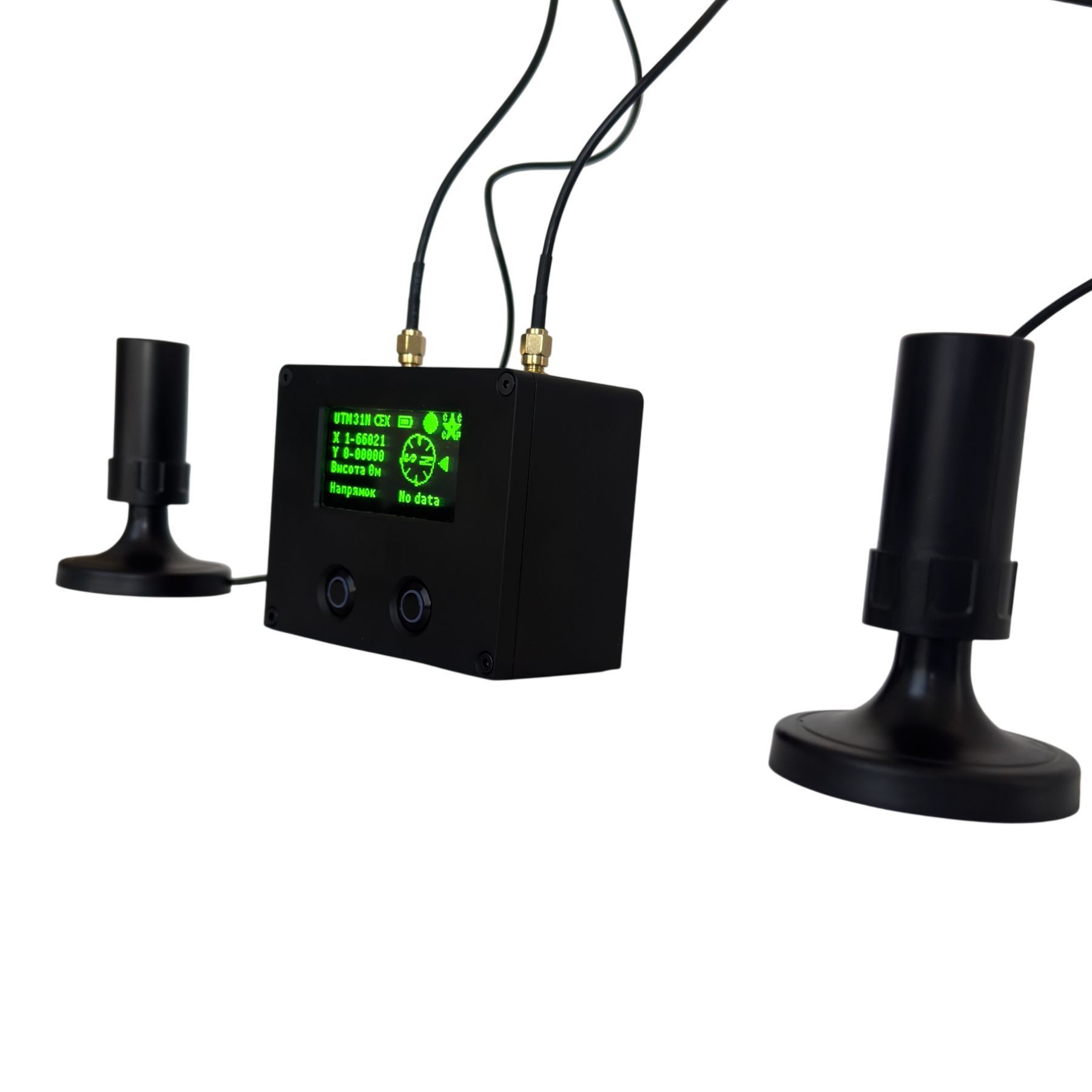
The TOPART base device – a GNSS signal receiver – was developed based on the NovAtel OEM617D electronic module (Calgary, Alberta, Canada). NovAtel is very expensive. We previously had solutions based on the Trimble MB2, but this is also an expensive chip. Therefore, we currently use the Unicore UM982, which provides reception and processing of signals from satellite systems. Replacement with a Septentrio chip is possible. It is cheaper than Trimble, but significantly more expensive than UM982.
One of the TOPART antennas is the so-called Master or primary antenna, while the second is the Additional or secondary antenna. Relative to the phase center of the primary antenna, the GNSS signal receiver calculates the current geographic coordinates. The additional antenna forms a baseline with the primary antenna, the orientation parameters of which (true azimuth and elevation angle) the TOPART base device determines immediately after the first navigation solution is obtained.
TOPART Design and General Operating Principles
Thanks to modern data processing methods, the first values of true azimuth and elevation angle are obtained almost instantly. The delay in providing angular parameters after the first navigation solution is obtained by the GNSS receiver may reach several seconds. The average value does not exceed 20 seconds.
The accuracy of angular measurements depends on the length of the baseline formed by the antennas. For example, the RMS error of angular measurements with a 2 m baseline is 0.08 degrees, while with a 4 m antenna baseline it is 0.05 degrees. The optimal baseline length between the antennas is from 4 to 10 m. Preliminary measurement of the baseline length between the antennas is not required.
Installation on the Object
To ensure normal operation of TOPART, it is first necessary to correctly select the locations for the GNSS receiving antennas, which must meet the following requirements:
- Both antennas must have as similar signal reception conditions as possible – an equally open section of the sky;
- Both antennas must receive only direct satellite signals, while signals reflected from the surrounding environment should be minimized as much as possible;
- Surrounding objects must not obstruct satellite signal reception for either antenna above 5° above the horizon;
- Each GNSS receiving antenna must be installed on a horizontal metal surface.
Installation on the Object
During operation, the TOPART angle-measuring device determines the azimuth or direction of the baseline relative to geographic north and the elevation angle of the antenna line. The possible azimuth range is from 0 to 360°, while the elevation angle range is from 0 to 85°.
The antennas should preferably be oriented along the longitudinal axis of the object; in this case, the direction of the baseline will correspond to the current heading. When selecting the antenna installation location, it should be taken into account that the measurement error of the true current azimuth depends on the length of the baseline and the measurement duration (the longer the satellite data is collected, the more accurate the result).
An important feature is the ability to operate in several coordinate systems: the WGS84 geodetic system and the SK-42 and MGRS (UTM) projection systems.
Calculations in the SK-42 system are performed based on the standard adopted in Russia, which ensures correct operation both in Ukraine and Russia.
Combat Proven
The TOPART device is capable of operating with a large number of multi-channel antennas, ensuring stable signal reception even under challenging conditions.
The interface and functionality of the device are specifically designed to solve topographic positioning tasks for artillery and mobile fire groups (MFG).
The effectiveness of TOPART operation has been confirmed in real combat conditions — the device is already successfully used on dozens of systems.
Technical Specifications
| Specification | Value |
|---|---|
| Number of channels | 432 |
| Operating frequencies | L1/L2 (GPS) |
| Data update rate | 10 Hz |
| Real-time positioning accuracy, horizontal | 1.5 meters |
| Real-time positioning accuracy, vertical | 2.5 meters |
| Positioning accuracy in data collection mode | ... up to 10 cm |
| Orientation accuracy with a 4-meter baseline in real time | 1-2 mil |
| Orientation accuracy with a 4-meter baseline in data collection mode | <1 mil |
| Types of geographic systems | WGS 84 (Geodetic), SK42, UTM (MGRS) |
| Continuous operating time without recharging | 24 hours |
Technical Specifications
| Specification | Value |
|---|---|
| Conversion of angles into projection angles (matching angles on the map) | Yes |
| Cold start time | 50 sec |
| Warm start time | 20 sec |
| Protection rating | Water-resistant, dust-resistant |
| Angle measurement units | degrees, mils (USSR), NATO mils |
| GNSS receiver type | Dual-antenna phase-based |
| Display type for data output | OLED, 128x64 monochrome |
| Menu type | Two-button |
| Antenna connectors | SMA |
| Antenna mounts | Magnetic |
| Antenna type | Helical, multi-band |
| Charging connector type | Type-C, 5V 1-2A |